![](/images/other/stat-length.png)
![Tour Wandern La Ferrière-aux-Étangs - La Ferrière - La Ferrière aux Etangs - Photo](https://media.geolcdn.com/t/1900/400/ext.pjpeg?maxdim=2&url=https%3A%2F%2Fservices.sitytrail.com%2FGeolivesWS%2FDownloadMedia.ashx%3FTrailID%3D111661%26Media%3D7899_2.jpg)
La Ferrière - La Ferrière aux Etangs
tracegps
Benutzer
![Länge](/images/other/stat-length.png)
Länge
14,3 km
![Maximale Höhe](https://static1.geolcdn.com/siteimages/upload/files/1508320355ic_sort_altitude_max_24dp.png)
Maximale Höhe
297 m
![Positive Höhendifferenz](https://static1.geolcdn.com/siteimages/upload/files/1508320355ic_sort_den_pos_24dp.png)
Positive Höhendifferenz
273 m
![Km-Effort](/images/other/stat-length.png)
Km-Effort
17,9 km
![Min. Höhe](https://static1.geolcdn.com/siteimages/upload/files/1508320355ic_sort_altitude_min_24dp.png)
Min. Höhe
195 m
![Negative Höhendifferenz](https://static1.geolcdn.com/siteimages/upload/files/1508320355ic_sort_den_neg_24dp.png)
Negative Höhendifferenz
273 m
![Boucle](https://static1.geolcdn.com/siteimages/upload/files/16400158638029165_repeat_loop_refresh_sync_direction_icon.png)
Boucle
Ja
Erstellungsdatum :
2014-12-10 00:00:00.0
Letzte Änderung :
2014-12-10 00:00:00.0
![Wandern](https://static1.geolcdn.com/sitytour/trail-icons/101.png)
3h04
Schwierigkeit : Medium
![Scannen Sie diesen QR-Code, um die Tour in der SityTrail-Anwendung zu öffnen](https://capi.geolives.com/qq0zvz2zws4bq2lad0pu/sitytour/trails/111661/qr.png?size=200)
Kostenlosegpshiking-Anwendung
Über SityTrail
Tour Wandern von 14,3 km verfügbar auf Normandie, Orne, La Ferrière-aux-Étangs. Diese Tour wird von tracegps vorgeschlagen.
Beschreibung
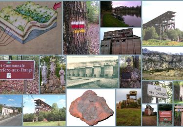
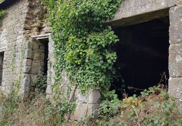
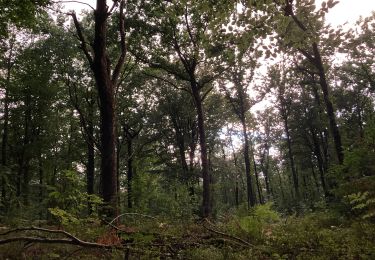
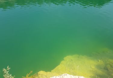
La Ferrière - La Ferrière aux Étangs Au cœur du Bocage, les traces anciennes et modernes de l'exploitation du minerai de fer sont encore présentes dans la mémoire des hommes et dans le paysage. Retrouvez les Coup de Cœur Randonnée dans l’Orne en Normandie.
Ort
Land:
France
Region :
Normandie
Abteilung/Provinz :
Orne
Kommune :
La Ferrière-aux-Étangs
Standort:
Unknown
Gehen Sie:(Dec)
Gehen Sie:(UTM)
682666 ; 5392696 (30U) N.
Kommentare
Touren in der Umgebung
![Tour Wandern La Ferrière-aux-Étangs - Circuit of IRON by Yannick-p14-61 - Photo](https://media.geolcdn.com/t/375/260/ext.jpg?maxdim=2&url=https%3A%2F%2Fmedia.geolcdn.com%2Ff%2Fe9109058-b6fa-4ee9-9d84-e1a504225bdf.jpg)
![Wandern Wandern](https://static1.geolcdn.com/sitytour/trail-icons/101.png)
Circuit of IRON by Yannick-p14-61
Wandern
Medium
(1)
La Ferrière-aux-Étangs,
Normandie,
Orne,
France
![](/images/other/stat-length.png)
13,3 km | 16,5 km-effort
3h 35min
![](https://static1.geolcdn.com/siteimages/upload/files/16400158638029165_repeat_loop_refresh_sync_direction_icon.png)
Ja
![Tour Wandern La Coulonche - La coulonche - Photo](https://media.geolcdn.com/t/375/260/ext.jpg?maxdim=2&url=https%3A%2F%2Fmedia.geolcdn.com%2Ff%2F95c3eac8-30e6-4fa2-8846-ef805e476c7d.jpg)
![Wandern Wandern](https://static1.geolcdn.com/sitytour/trail-icons/101.png)
La coulonche
Wandern
Sehr leicht
La Coulonche,
Normandie,
Orne,
France
![](/images/other/stat-length.png)
3,7 km | 4,9 km-effort
1h 22min
![](https://static1.geolcdn.com/siteimages/upload/files/16400158638029165_repeat_loop_refresh_sync_direction_icon.png)
Ja
![Tour Wandern La Ferrière-aux-Étangs - 1h16 - Photo](https://media.geolcdn.com/t/375/260/ext.jpg?maxdim=2&url=https%3A%2F%2Fmedia.geolcdn.com%2Ff%2F30fe1b0a-da55-41f8-8ede-6b74633fdbd3.jpg)
![Wandern Wandern](https://static1.geolcdn.com/sitytour/trail-icons/101.png)
1h16
Wandern
Medium
La Ferrière-aux-Étangs,
Normandie,
Orne,
France
![](/images/other/stat-length.png)
6,4 km | 8,5 km-effort
1h 16min
![](https://static1.geolcdn.com/siteimages/upload/files/16400158638029165_repeat_loop_refresh_sync_direction_icon.png)
Ja
![Tour Wandern Le Châtellier - chatellier - Photo](https://media.geolcdn.com/t/375/260/ext.jpg?maxdim=2&url=https%3A%2F%2Fstatic1.geolcdn.com%2Fsiteimages%2Fupload%2Ffiles%2F1553511878bg_sport_marche.png)
![Wandern Wandern](https://static1.geolcdn.com/sitytour/trail-icons/101.png)
![Tour Wandern Dompierre - mines - Photo](https://media.geolcdn.com/t/375/260/ext.jpg?maxdim=2&url=https%3A%2F%2Fstatic1.geolcdn.com%2Fsiteimages%2Fupload%2Ffiles%2F1553511878bg_sport_marche.png)
![Wandern Wandern](https://static1.geolcdn.com/sitytour/trail-icons/101.png)
![Tour Wandern La Ferrière-aux-Étangs - La Feriere aux etant - Photo](https://media.geolcdn.com/t/375/260/ext.jpg?maxdim=2&url=https%3A%2F%2Fmedia.geolcdn.com%2Ff%2Ff76f6a14-4f12-4d3c-ba5b-00c3b8cd2d26.jpg)
![Wandern Wandern](https://static1.geolcdn.com/sitytour/trail-icons/101.png)
La Feriere aux etant
Wandern
Sehr leicht
La Ferrière-aux-Étangs,
Normandie,
Orne,
France
![](/images/other/stat-length.png)
1,2 km | 1,3 km-effort
36min
![](https://static1.geolcdn.com/siteimages/upload/files/16400158638029165_repeat_loop_refresh_sync_direction_icon.png)
Ja
![Tour Wandern Dompierre - Dompierre; trace GPS du 10/09/2019 - Photo](https://media.geolcdn.com/t/375/260/ext.jpg?maxdim=2&url=https%3A%2F%2Fstatic1.geolcdn.com%2Fsiteimages%2Fupload%2Ffiles%2F1553511878bg_sport_marche.png)
![Wandern Wandern](https://static1.geolcdn.com/sitytour/trail-icons/101.png)
Dompierre; trace GPS du 10/09/2019
Wandern
Sehr leicht
Dompierre,
Normandie,
Orne,
France
![](/images/other/stat-length.png)
8,2 km | 10,2 km-effort
4h 30min
![](https://static1.geolcdn.com/siteimages/upload/files/16400158638029165_repeat_loop_refresh_sync_direction_icon.png)
Ja
![Tour Wandern Dompierre - Dompierre longue - Photo](https://media.geolcdn.com/t/375/260/ext.jpg?maxdim=2&url=https%3A%2F%2Fstatic1.geolcdn.com%2Fsiteimages%2Fupload%2Ffiles%2F1553511878bg_sport_marche.png)
![Wandern Wandern](https://static1.geolcdn.com/sitytour/trail-icons/101.png)
Dompierre longue
Wandern
Medium
Dompierre,
Normandie,
Orne,
France
![](/images/other/stat-length.png)
8,3 km | 10 km-effort
2h 13min
![](https://static1.geolcdn.com/siteimages/upload/files/16400158638029165_repeat_loop_refresh_sync_direction_icon.png)
Ja
![Tour Wandern La Coulonche - UIA LF 28/11/2018 - Photo](https://media.geolcdn.com/t/375/260/ext.jpg?maxdim=2&url=https%3A%2F%2Fstatic1.geolcdn.com%2Fsiteimages%2Fupload%2Ffiles%2F1553511878bg_sport_marche.png)
![Wandern Wandern](https://static1.geolcdn.com/sitytour/trail-icons/101.png)
UIA LF 28/11/2018
Wandern
Einfach
La Coulonche,
Normandie,
Orne,
France
![](/images/other/stat-length.png)
7,5 km | 9,3 km-effort
2h 0min
![](https://static1.geolcdn.com/siteimages/upload/files/16400158638029165_repeat_loop_refresh_sync_direction_icon.png)
Ja